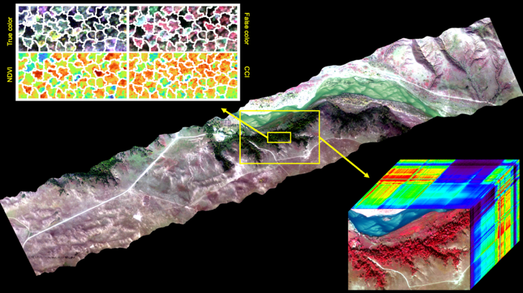
True-color image from an aircraft flight line over Niobrara ForestGEO plot (yellow box), October 11, 2021. The image cube shows a NIR-enhanced rendition, highlighting the forest vegetation in red, with prairie in brown and Niobrara River in blue. The Z-dimension shows a full spectrum obtained for each pixel, with colors illustrating spectral differences between landscape features and tree canopies. The upper left image shows a forest detail, with tree canopies outlined in white, and four different renditions of spectral information useful for tree identification and functional assessment. Image processing: Ran Wang
Investigator, NASA Space Grant, NASA (Primary Investigator: Ran Wang)
The Nebraska Earth Observatory (NEO) offers advanced airborne sensors, including an imaging spectrometer, an imaging fluorometer, and a thermal imager for studying ecosystem function and vegetation distribution, biodiversity, and physiology in a changing world. Operated by CALMIT in the School of Natural Resources, Lincoln NE, flights are made available at cost. Positions available include flight technician, instrument technician and informatics technician, as well as student (trainee) positions. Image processing: Ran Wang